XSD
XSDIATA code
KTNXICAO code
3,658 mlongest of 1 runway
1,691 melevation · 5,548 ft
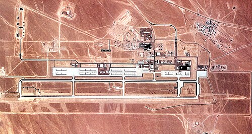
Tonopah Test Range Airport (XSD/KTNX) is an airport in the United States, in Nevada.
It has 1 runway, the longest 3,658 m, at an elevation of 1,691 m.
Identification
- IATA
- XSD
- ICAO
- KTNX
- FAA LID
- TNX
- Wikidata
- Q5659192
Location
- Country
- United States
- Located in
- Nevada
- Coordinates
- 37.7947, -116.7786
- Elevation
- 1,691 m (5,548 ft)
Organisation
- Type
- airport
- Operator
- Air Combat Command
Runways
- 14/32
- 3,658 m · 12,001 ftconcrete