WST
WSTIATA code
KWSTICAO code
36.6Kpassengers in 2019
1,222 mlongest of 2 runways
25 melevation · 82 ft
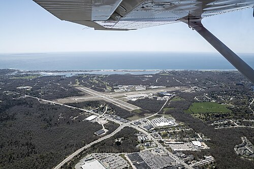
Westerly State Airport (WST/KWST) is an airport in the United States serving Westerly.
It handled 36,586 passengers in 2019.
It has 2 runways, the longest 1,222 m, at an elevation of 25 m.
1 airline uses it as a hub: New England Airlines.
Passengers per year
2016–201934.4K34K35.4K36.6K
2016’162017’172018’182019’19
Identification
- IATA
- WST
- ICAO
- KWST
- Wikidata
- Q7987415
Location
- Country
- United States
- City served
- Westerly
- Located in
- Rhode Island
- Coordinates
- 41.3497, -71.8033
- Elevation
- 25 m (82 ft)
Organisation
- Type
- airport, commercial traffic aerodrome
- Named after
- Westerly
Runways
- 14/32
- 1,207 m · 3,960 ftrock asphalt
- 07/25
- 1,222 m · 4,009 ftrock asphalt
Hub for 1 airline
EJNew England Airlines