SER
SERIATA code
KSERICAO code
1,829 mlongest of 4 runways
178 melevation · 584 ft
1948opened
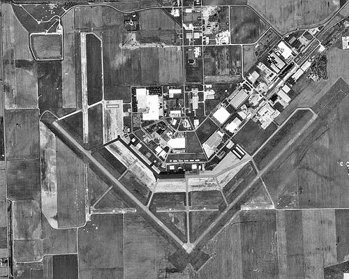
Freeman Municipal Airport (SER/KSER) is an airport in the United States serving Seymour.
It has 4 runways, the longest 1,829 m, at an elevation of 178 m.
Identification
- IATA
- SER
- ICAO
- KSER
- Wikidata
- Q5501026
Location
- Country
- United States
- City served
- Seymour
- Located in
- Indiana
- Coordinates
- 38.9247, -85.9083
- Elevation
- 178 m (584 ft)
Organisation
- Type
- airport
- Opened
- 1948-11-01
- Owner
- Seymour
Runways
- 9/27
- 336 m · 1,102 ftpeat
- 14/32
- 1,677 m · 5,502 ftrock asphalt
- 18/36
- 370 m · 1,214 ftpeat
- 05/23
- 1,829 m · 6,001 ftrock asphalt