GAI
GAIIATA code
KGAIICAO code
148passengers in 2019
1,281 mlongest of 1 runway
164 melevation · 538 ft
1960opened
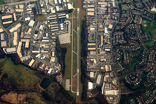
Montgomery County Airpark (GAI/KGAI) is an airport in the United States serving Montgomery County.
It handled 148 passengers in 2019.
It has 1 runway, the longest 1,281 m, at an elevation of 164 m.
Passengers per year
2016–20191127484148
2016’162017’172018’182019’19
Identification
- IATA
- GAI
- ICAO
- KGAI
- Wikidata
- Q3612322
Location
- Country
- United States
- City served
- Montgomery County, Washington metropolitan area
- Located in
- Montgomery County
- Coordinates
- 39.1683, -77.1660
- Elevation
- 164 m (538 ft)
Organisation
- Type
- airport
- Opened
- 1960-08-22
- Named after
- Montgomery County
Runways
- 14/32
- 1,281 m · 4,203 ftrock asphalt